Crop scouting, 3-D mapping, spot spraying and pathogen detection all could be performed by unmanned aerial vehicles to cut labor and input costs and improve decision making.
In the not-so-distant future, farmers wanting to scout fields for diseases and pests, spot spray for weeds or obtain 3-D maps of their farm ground will be turning to tiny autonomous helicopters or planes to do the job.
Armed with powerful cameras, these unmanned aerial vehicles (UAVs) — known in popular culture as “drones” — can cover hundreds of acres in an hour and provide a birds-eye view of fields down to canopy level.
After establishing a foothold in the military, agriculture is seen as one of the last frontiers for UAV use because of the increased use of precision technology in farm operations. The units are already being used in Canada, Europe, Asia and South America for various tasks.
The UAV market is mostly undeveloped in the U.S. due to strict FAA regulations, but some farmers are buying the units anyway or requesting demonstrations. The FAA in 2015 is expected to reveal a plan for integrating UAVs into airspace rules, but it’s unclear how long it would take to implement the guidelines.
Rory Paul — whose Chesterfield, Mo., company, Volt Aerial Robotics, makes and sells rotary-copter and small fixed-wing UAVs — believes the units are “personal farming implements” that can help farmers get more timely, accurate information about their crops and fields.
“We should have the right to operate these technologies over our properties, to the benefit of the ground below,” he says.
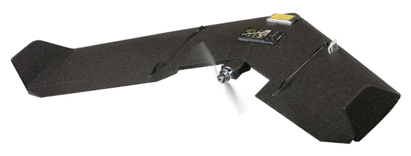
UAV Basics

Study Aid: Fixed-wing and rotary-copter UAVs were demonstrated last summer for the Iowa OnFarm Network, where a corn-rootworm management trial was under way. Rory Paul of Volt Aerial Robotics used a fixed-wing CropCam UAV to map the 200-acre field in 30 minutes (right), then showed researchers how to use real-time imagery from Volt’s rotary craft — sent back to a computer on the tailgate of a pickup (below) — to find spots in the field marked with GPS from imagery. (Photos courtesy of Rory Paul)

Typically, UAVs are small enough to fit into a small suitcase and are launched from the side of a field or area of interest. Guided by a radio controller, laptop computer or tablet, the device flies between pre-determined waypoints to film or photograph the desired field areas.
Cameras on the UAVs may take two-dimensional, high-definition photos where every pixel is linked to a GPS location on the ground. The UAVs can also transmit live video images from the flight to ground control.
Depending on the model, some cameras can take thermal images of plants in fields or 3-D models that depict subtle changes in elevation can be built from these images using software.
The accuracy of UAV maps may range from 12 inches to only a quarter inch, depending on how many ground-control points there are. Going for sub-inch accuracy takes time and money, but it’s achievable, Paul says.
“As long as you have one ground-control point every quarter of a mile, you can get sub-meter accuracy,” Paul says. “Corrections are done post process.”
Rotary-wing UAVs can fly up to 20 minutes, depending on the payload, and fixed-wing units can fly about an hour. Ranges can differ depending on the controller, but most UAVs have a range of 2 to 4 miles.
The rule of thumb with operating UAVs in wind conditions is that bigger UAVs can withstand greater forces. The rule of thumb with operating UAVs in wind conditions is that bigger UAVs can withstand greater forces. Smaller rotary helicopters can be flown in winds gusting anywhere from 20 to 52 mph, while fixed-wing systems must fly into and out of the wind rather than across it to generate satisfactory images.
Some UAVs allow operators to upload new directions in flight so the unit can change missions or direction. And if the radio link is lost and not reestablished — or the battery begins to go out — the device will fly back to the launch point.
Prices range from $500 for basic units currently found on the Internet to near $100,000, although Paul believes U.S. pricing will fall significantly in the coming years.
A major advantage of UAVs is they’re highly deployable.
“If you need me tomorrow in Nebraska, I can pack the UAV into a suitcase and I’m heading out there to go on a flight,” he says.
Changing Agriculture
UAVs may indeed change the way farm decisions are made, especially when the technology and point of view provided by the units can be combined with ground truthing to document conditions in fields.

New Perspective: This photo shows how UAV cameras and software can be used to generate 3-D images of fields, potentially helping farmers fine-tune hybrid selection or nutrient applications or decide on the location of tiles. (Photo courtesy of Rory Paul)
Drew Janes, who founded Jackson, Mo.-based Aerial Precision Ag just a few months ago, set up a booth at the 2013 Ag Connect Expo in Kansas City and sold out of his inventory.
About a year ago, he built some of the drones for his company, Relentless Inc., to film farm operations for Case IH. Then he brought a UAV to last year’s Farm Progress Show and had dozens of farmers ask where they could get one.
Janes says APA has worked to create an easy-to-use UAV kit that can be deployed in less than 2 minutes from opening the machine’s carrying case.
“Farmers are searching for ways to make operations more efficient and practical because scouting crops and managing fertilizer, or water use, is a huge time-intensive task,” says Janes, who grew up working for his parents’ fertilizer chemical dealership in the Midwest. “Most of our interested customers are row-crop farmers, but at some shows you see livestock farmers who want them to check on cows or what’s happening in pastures, as well as feed and water needs.”
In Canada, where a regulatory framework is already in place for UAV use, these units are already helping farmers gather valuable data, assess environmental conditions and maximize yields.
Aeryon Labs Inc, based in Waterloo, Ontario, sells the Scout, a quadcopter that is capable of taking daytime and near-infrared images and merging them into Normalized Difference Vegetation Index (NDVI) images that can ascertain plant health, soil and water conditions and biomass production.

Bird's-Eye View: Images taken from a Swinglet CAM drone over a field in Ontario last year show areas with higher or lower organic matter. Below, the yellow-green line in the photo’s center is an old fence row and yellow-red areas indicate silty soils with higher organic matter. (Photos courtesy of Felix Weber)

Imagery taken during flights can also be imported into GIS databases, stitched together with special software and used to generate 3-D reconstructions of fields.
In theory, farmers using a UAV such could monitor farm operations at the same time every day or week and make proactive decisions, says Cameron Waite, Global Sales Manager for Aeryon Labs.
“From a crop perspective, farmers can monitor and make decision on the application of water, fertilizer and pesticides,” Waite told attendees at the 20th annual Southwest Agricultural Conference in Ontario. “If you’ve got a hailstorm coming, or one just came through, you could see how your land was affected.”
NDVI images could be especially useful to help farmers see how healthy their crop is or catch issues with crop stress, water, nutrients or weeds that they might have missed with the naked eye and avoid having to make decisions about inputs that aren’t necessary.
“You can do precise, targeted applications of pesticides, nutrients and fertilizer and keep your costs down,” Waite says.
Multispectral cameras let farmers identify crop health, perform risk mitigation and even identify soil health.
In the future, hyperspectral cameras will let farmers identify specific vegetation types.

Out To Work: UAVs, such as Aerial Precision Ag’s multi-rotor unit were meant to help farmers with numerous field tasks, says Drew Janes, who founded the Jackson, Mo., company earlier this year. This could include scouting fields and pastures, looking for weed patches or even monitoring irrigation equipment. (Photos courtesy of Drew Janes)

If ragweed affecting corn has six spectrums of light, the light bounces back in the sky and is picked up by the camera.
At a vineyard in British Columbia, a grape farmer trying to get a better understanding of his conditions was having geographical challenges. He used the Scout to take 90 images in 8 minutes over 7.5 acres, and generated image resolutions of 1.6 centimeters per pixel.
“Satellites may give you 1 meter per pixel and airplanes may give you 30 to 50 centimeters per pixel,” Waite says. “A fixed-wing UAV gets you about 5 centimeters per pixel. But we can get around 1 centimeter to as low as 3 millimeters per pixel.”
Follow The Map
Already, small fixed-wing UAVs launched to fly over fields are helping farmers and ag crop consultants in Ontario.
Felix Weber, who founded Ag Business & Crop in Palmerston, Ontario, after more than 20 years of farming, is also a distributor for sense-Fly’s Swinglet CAM and eBee fixed-wing UAVs.
Weber has a pilot’s license and has always been keen to what can be seen in a farmer’s field from above.
He tried working with satellite imagery, but said he was frustrated with the 1- to 2-week turnaround he was getting — and if the weather changed while he was waiting for images to be sent, it was too late.
Weber feels fixed-wing UAVs work better for scouting and mapping larger farm areas.
“The CAM shows me patterns, things that I don’t see from the ground, and gives it to me in a format where I can make maps and extract GPS coordinates to go to a specific point in field,” Weber says.
In one project in Ontario involving a test plot for local companies supporting strip-till, Weber used a UAV to fly over a field every 3 weeks for an entire growing season to document emergence, growth and harvest of corn.
One type of map showed him the different soil types and organic matter — including an area where an old fencerow was located that, several years later, still showed higher levels of organic matter than surrounding farm ground.
After corn was planted at a population of 40,000 seeds an acre, he flew his UAV over the crop and got NDVI images that showed emergence wasn’t optimal in some areas. Using the GPS tags from the images, he found that field area and determined it had heavier clay content.
“The equipment didn’t go quite as deep there, so the planting depth was less than other areas,” Weber says.
At the end of the season, he compared the last few NDVI images he took to maps generated from his yield-monitor data and the images were very similar.
“It accurately showed me healthy areas of the field compared to stressed areas, so I was able to compare them and calibrate the data afterwards,” he says. “When we looked at images from the beginning to the end of the season, the stressed area was a lot bigger than it was at beginning of the season because we had such a dry season.”
A few years ago, Weber did drainage maps for a farmer who didn’t know where his tile lines were located. After a rainy period where there some good drainage activity was taking place, images taken by the CAM showed where the tiles were located because the crops around them were in better health.
“You could see exactly where the lines were,” he says.
Farms In 3-D
Another way UAVs could improve farmer decision-making is through mapping fields with 3-D technology to provide detailed topographical images where soil changes might be present.

Tiles Found: An image (above) taken by a senseFly’s Swinglet CAM fixed-wing drone (below) helped a farmer identify where tile lines were located in his field. The GPS-tagged photo also created a record of the tile locations for the Ontario farmer, says Felix Weber of Ag Business & Crop in Ontario. (Photos courtesy of Felix Weber)
“If you have perfectly flat fields, there may be no interest. But what if you have a 50-foot difference in elevation from one side of the field to the other?” suggests Paul of VAR.
While the technology may not be there yet, UAV-produced 3-D maps could even help farmers fine-tune hybrid selection for higher elevations with less water or lower elevations with more water and higher organic matter.
“In hilly areas, you may use a different variety that isn’t a racehorse hybrid but still works well, while in lower areas you may use the racehorse variety,” Weber says.
“And with water management,” Paul adds, “where am I going to put drainage tile in a field? A farmer may know some of these things intuitively, but if you have a couple thousand acres, this information might be insightful.”
Weber believes 3-D maps could be an additional tool to help farmers decide where to apply lime or other nutrients.
“When you only look at yield data, you’re seeing the removal rate,” Weber says. “That doesn’t mean there is no potential in the lower-yielding areas, it’s just that something is going on that is hurting yields. Could it be fixed?”
Cut Herbicide Costs
In an advanced setup, it’s possible that farmers could use a combination of UAVs for spot weed control, saving time and money spent on herbicide applications.

Seeing Weeds: A photo taken by a fixed-wing UAV used by Airphrame, a Davis, Calif.-based ag consulting company, shows weeds emerging in a tomato field. UAVs could play an important role for and crops consultants in tracking not only weeds, but crop growth and health, says Airphrame co-founder and CEO Bret Kugelmass. (Photo courtesy of Bret Kugelmass)
In theory, Paul says the process would start with a small, inexpensive UAV that maps a field at high resolution with a multispectral camera.
After the images are geo-referenced and auto-rectified to provide an accurate representation of the field, the location of weed patches is relayed to a larger, helicopter-type UAV that spot-sprays the patches with herbicides. Paul says the Japanese Department of Agriculture and Fisheries has been flying and certifying UAV systems for agriculture use for 20 years. A popular model, the Yamaha RMAX, is used to spray for weeds in rice fields.
“This isn’t going to replace crop spraying, but it could augment spraying on a spot-application basis,” Paul says.
Scouting Crops
Crop scouting could be the best and highest use for UAVs.
Last summer, Paul demonstrated both four-rotor and fixed wing UAVs in Hardin County, Iowa, where the Iowa Soybean Association On-Farm Network had a corn-rootworm management trial under way. The trial contained replicated strips of half-rate and full-rate insecticide with a Bt-rootworm hybrid.
“We’d already done quite a bit of work in the field using our own aerial imagery to locate problem areas,” says On-Farm Network spokesman Mick Lane. “Rory mapped the entire 200- acre field with the fixed-wing plane in about 30 minutes.
“Then he showed us how to use the real-time imagery, sent back to a computer on the tailgate of a pickup, from the camera on the rotary-wing craft to find spots in the field we’d marked with GPS from our imagery.
“We got excellent, deadly accurate images from that, which would have helped us immensely in walking into those areas after the GPS data was transferred into our handheld GPS devices.”
UAVS could be valuable in assessing crop populations early in the season before the growing foliage makes individual plants indistinguishable.
“You could choose a spot in the field and count how many plants are in a row. The multi-copter will go back to that same exact spot and take another count,” Paul says. “You can get population counts more quickly and you can do a lot more of them.

“Later in the season, when the plants are too tall to be able to see the field, you can still get a general overview of the field. If you spot a problem, you can drop it down and determine what’s going on, or take a still image and walk out and do ground truthing because you have the GPS location.”
“Another benefit is on farms with pivot irrigation,” says Janes of APA. “You may have a problem with stand 3 or a nozzle at stand 4 is blocked. You can go scope the problem without walking through a muddy field — and you can have the info in minutes.”
UAVs could be useful as well for farmers, consultants or crop-insurance agents for scouting for damage from weather events, harmful insects, dis- eases or chemical drift.
“That can be very hard to judge from the ground,” Weber says. “When you walk into a field, how do you really make a decision if it’s 70% still good or 90%?
“With an aerial image, you can see how large the percentage is and go to that field area and decide if it’s an acceptable loss or unacceptable. It’s easier to make an informed choice.
“Or when I see that plants are stressed, I can go out and see if I can apply nutrients to help them recover. You can make a change at the beginning of the season, when it’s still possible.”
Reducing Input Costs
There’s plenty of potential for UAVs to help West Coast farmers growing high-value crops gather quality data and reduce input costs through the use of aerial imaging, says Bret Kugelmass, founder and CEO of Airphrame, a precision farming consulting group in Davis, Calif., that uses fixed-wing UAVs made in-house.
Started by former Stanford University roommates Kugelmass, Peter Strohm and William Grossman, Airphrame does the aerial imaging and collects and helps farmers analyze the data so customers don’t have to purchase or handle UAVs or learn how to fly them.
The company has worked with farmers who have done trials with variable-rate seeding for vegetables, helping them plant lower-cost seed on poorer soils and better hybrids on higher-performing soils.
“Understanding what seeds go where requires some input from the farmer,” Kugelmass says. “But we get high-resolution data points throughout the field that are far better resolution than with a soil-based measuring unit. We can get sub-meter resolution to see gradients of soils.”
Doing this work with corn hybrids would take even more input from a farmer, “but we can help them capture where everything is happening on the farm by GPS tagging everything,” Kugelmass says. “If you want someone to develop a gradient of soil quality or conditions, then experiment with different hybrids to see how they perform throughout season, there was no way to cost effectively do that before.”
Another use for UAVs would be monitoring crop progress before harvest. Kugelmass says a lot of tomato farmers set up contracts with canneries and must meet production goals based on a schedule that isn’t based on the optimal use of land itself.
“There’s no great way to predict the growth of those plants because an weather patterns change so quickly,” Kugelmass says. “Now with UAVs, we have a way to track plant growth with a high degree of accuracy and optimize harvest time. With all this data collected over many fields, you won’t have to leave product on the field and you can use land more effectively.
“What if you could see fields on a see map ahead of time before bringing outs, the tractor?”
Lane of the ISA On-Farm Network says the immediacy of having the imagery was desirable.
But if a farmer wants an entire field mapped out in one image and have it work with GPS, it takes several days es to get photos stitched together — although he expects software improvements to narrow that gap.
The On-Farm Network’s usual aerial imagery provider, GeoVantage, typically provides about 2 days turnaround on whole-field imagery, with 1- to 2-meter resolution.
“While this isn’t as good as what we got from Rory, it’s way better than satellite imagery that’s available to us,” Lane says “For now, though, we could perhaps use UAVs for scouting fields.
“But I don’t see them replacing what we get from GeoVantage for quite awhile.”
Finding Pathogens
In the future, UAVs could detect, monitor and forecast the spread of fungus-like organisms like Phytophthora or Fusarium that put crops at risk. Since 2008, several researchers and students at Virginia Tech University have been deploying UAVs for “aerobiological sampling” at the university’s 3,200-acre Kentland Farm near Blacksburg, Va.
Grants from the USDA and National Science Foundation have paid for the work conducted by plant pathology professor David Schmale, researcher Shane Ross, aerospace engineering professor Craig Woolsey and several others at the university.
The fixed-wing UAVs are fitted with spore-sampling devices on their wings that open and close like a clamshell as they trap airborne particles traveling hundreds of feet above the farm.
Using UAVs allows for high-volume sampling, which is important for collecting statistically significant samples of sparsely distributed airborne particles, the university says.
Types of sampling surfaces in the plates include grease, sticky tape and filter papers coated with glycerin to collect a varied sample of microbes, which are then inspected in a lab using DNA-based analyses.
Other sensors on the aircraft include an ionic spore sensor and a device with a technology called surface plasmon resonance (SPR) that allows users to detect an agent in real time and identify biological agents while the UAV is flying.
Once identified, the researchers can hypothesize where a sample was flowing from based on the time of year.
The university also does back-trajectory analysis to test that hypothesis and looks for seasonal trends in what they’re collecting.
“Some of the species are exclusively localized to a certain region or certain crop type, so if you’re collecting a tropical species, for example, during the winter time in Blacksburg, Va., then you might question, ‘Well, it’s likely coming from some warmer, tropical region,’” Schmale recently told the Association For Unmanned Vehicles Systems International (AUVSI).
Schmale, Woolsey, and colleagues were initially interested in understanding how Phytophthora infestans, a high-risk plant pathogen that causes late blight of potatoes and tomatoes, is transported through the atmosphere.
Currently, with the NSF funds, Schmale and Ross are tracking Fusarium, which is responsible for some of the world’s most devastating plant and animal diseases.
Before the UAV research began, there was limited knowledge on the long-distance transport of Fusarium in the lower atmosphere.
“We know that microbes mediate important biochemical processes in the soil, the ocean and a variety of extreme environments,” Schmale says. “It isn’t so far-fetched that a similar drama unfolds in the atmosphere, which is teeming with microbial life.
“In many of our samples, we’ve found organisms that have never been cultured before. Some of these microbes may thrive only in the atmosphere, and many of them may be new to science.”